
 @wxornotBG Facebook
 @wxornotBG Twitter
 @wxornotBG Instagram

Good morning, Kentucky! I hope everyone had a wonderful week and is ready for a break. We have scattered storm chances this weekend, so I’ll fill you in on all the details below!
Storms by Midday
Our morning will start off dry and eventually transition into scattered thunderstorms across the region. The high temperature for today will each into the upper-80s and be accompanied by upper-60s dew points.
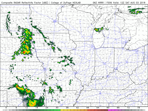
We’re pretty used to hot, muggy, stormy weather by this point, so today will be nothing out of the ordinary. If you have plans for tonight, be mindful that these scattered thunderstorms could potentially hang around until after sunset.
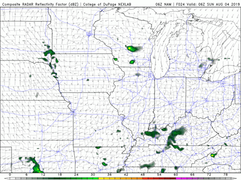
Chance of Early Day Showers Tomorrow
Tomorrow will be fairly similar to today. Chances for showers will start in the morning and should clear up during the afternoon. By tomorrow evening, rain will no longer be an issue. High temperatures and dew points will be back up to the upper-80s and low-70s.
Starting the Week Dry
Any and all rain that we will encounter this weekend should be cleared out by Monday and allow us to begin another work week with a dry start. Temperatures will remain in the upper-80s, but the dew points will dip a few degrees and hang in the mid-60s. Any help from Mother Nature in regards to lowering the dew point is always appreciated!
![]()
That concludes today’s post! I hope everyone has a great weekend. Remember to follow @wxornotBG on Twitter to stay up to date with these scattered showers and storms. See you next time!