
 @wxornotBG Facebook
 @wxornotBG Twitter
 @wxornotBG Instagram

Good morning, Kentucky! Barry’s storms look to continue with high temperatures tagging along with them. I’ve got all the details below!
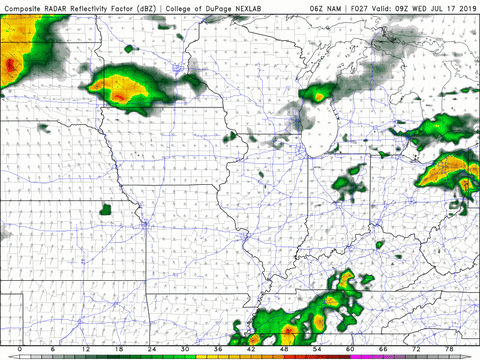
Afternoon Storms Today
Today will start off dry but as we progress towards the afternoon, thunderstorm chances will increase. The thunderstorms should arrive near lunchtime and will be scattered throughout the area.
The high temperature will reach the upper-80s and winds will be rather gusty. Sustained winds throughout the day will linger around 10-15 MPH with gusts near 30 MPH. The overnight low will dip into the mid-70s.
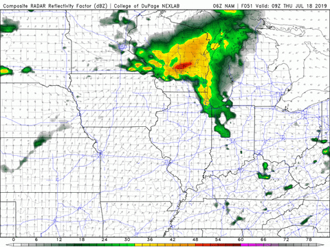
Showers For First Half Of Wednesday
Tomorrow’s showers are most likely to occur during the morning commute and lunchtime. The later afternoon and evening looks dry.
The high temperature will be a few degrees cooler than today reaching only into the low to mid-80s. Winds will be calmer as well but with a dew point in the mid-70s, get ready for a muggy day.
Chance Of Rain On Thursday
I know it’s shocking, but there’s going to be the potential for more afternoon storms on Thursday. The morning looks dry but as the afternoon rolls around, shower chances will increase.
Be aware that with the temperature reaching the upper-80s and the dew point in the upper-70s, the heat index (what it will actually feel like outside) will be in the low-100s. Remember to stay hydrated and wear plenty of sunscreen when going outside.
End of the Week/Weekend Outlook
Friday looks to be our first fully dry day of the week. Although that sounds good, the temperature and dew point combination will send the heat index back into the low-100s. Saturday will be very similar to Friday with a minimal chance of rain and hot temperatures. In summary, this weekend is going to be very hot.

That concludes today’s post! Make sure to check in with @wxornotBG on Twitter for live updates regarding this week’s rain. Have a great day!