@wxornotBG Facebook
 @wxornotBG Twitter
 @wxornotBG Instagram

Good morning, Kentucky! I hope everyone had a great weekend and productive start to the work week. The next few days will consist of warm and dry conditions with very minimal precipitation chances. Although our days will be warm, our temperatures are actually going to be below average for this time of year.
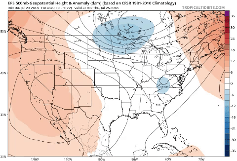
Today we will see highs in the mid-80s with dew points sticking around the mid to upper-60s for the majority of the day. Northerly winds will continue due to the digging trough centered over central Kentucky with an almost perfectly vertical trough axis aligned with Interstate 75. As for rain, it looks to remain to our east and leave us with dry conditions for the day. There is about a 20% chance for a rain shower during the afternoon hours, but nothing overly promising. Partly cloudy skies as well as a low in the mid-60s will help give us a break from the heat.

Wednesday
Tomorrow will be very similar to today with slightly warmer temperatures. The high will max out around the upper-80s with dew points in the mid to upper-60s once again. Our winds will be out of the northwest as that digging trough that is centered over our region today will slightly move eastward. Precipitation chances will be rather minimal throughout the entire day with the best chance being during the afternoon with a 10% of a shower. Lows will only dip to the upper-60s as the skies will remain mostly clear and sunny for the entire day.

Thursday
Thursday will pretty much be a repeat of today and Wednesday with a high in the upper-80s and dew points in the mid to high-60s. With that low pressure system finally moving eastward and out of our area, the winds will become increasing zonal (horizontal flow) as the week progresses. There is little to no chance of a rain shower, so it looks like Thursday will be dry as well. You can expect to see mostly sunny skies with minimal cloud cover.

That concludes your Tuesday forecast! We’ll see you back here tomorrow morning but in the meantime, follow @wxornotBG for all weather updates. Have a great day!