
 @wxornotBG Facebook
 @wxornotBG Twitter
 @wxornotBG Instagram

This Afternoon – Increasing Clouds, Iso’d Showers – High 57 / Tonight – Mostly Cloudy, Low 46
4pm 55 ~ 7pm 49 ~ 10pm 47 ~ 1am 47 ~ 4am 46
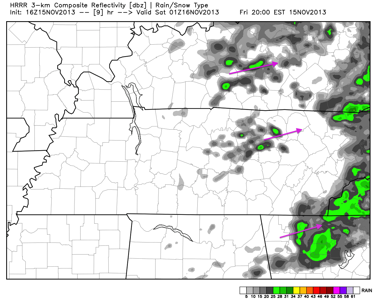
Forecast is on track up to this point, friends. Scattered, light showers have pestered us throughout this morning, and will continue to do so through the afternoon, as Gulf moisture streams over our proximity. By the time we get into this evening and tonight, a dry lull in the activity should take place. The latest HRRR radar, provided below, agrees with this idea. It is valid for 7pm, and shows leftover rain moving out of the area. Good news for all of you high school football fans:
Sat- Isolated Showers & Storms, BREEZY – High 68 / Sat Night – Scat’d Showers & Storms – Low 57
7am 48 ~ 10am 58 ~ 1pm 68 ~ 4pm 64 ~ 7pm 57
A surface low still looks to develop over the Plains 0n Saturday, and begin to deepen (intensify) as it pushes northeast toward the Great Lakes. In response to this, south central Kentucky will be placed in the warm sector of this evolving weather maker.
A warm, moist airmass will advance northeast into our proximity from the Gulf, setting up an atmosphere capable of producing isolated – scattered showers and storms. Southerly winds of 10-20mph will take temperatures into the mid – upper 60s.
Sunday – Scat’d Showers & Storms (Potentially Severe) – High 72
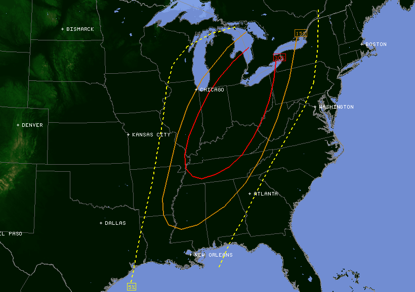
Latest models continue to paint the same picture regarding Sunday’s potential for severe weather. Warm, moist air will be pumped into our area, helping parameters align for a potential inclement event to unfold. The image provided is the latest Convective Outlook from the SPC, valid for Sunday. It includes the entire state of Kentucky in a “Slight Risk” for severe weather. South central Kentucky has been included in a 30% probability of severe weather occurring within 25 miles of any given location:
The most recent model runs continue to struggle with the timing of this event. I still believe Sunday afternoon – Sunday night will be the time frame for heightened concern. Parameters are in place for a squall line (possibly multiple lines from a QLCS setup) to develop and propagate over the area, leading a strong cold front that will pass to our east Sunday night. Damaging winds look to be the main threat, along with the potential for isolated tornadoes. PLEASE stay up to date on this weather maker through the weekend.
That will be all for the time being, folks. I’ll be back tomorrow with a fresh update regarding our severe weather chances. Enjoy what’s left of your Friday, and thanks for reading!