
 @wxornotBG Facebook
 @wxornotBG Twitter
 @wxornotBG Instagram

Good morning, Kentucky! Seasonal weather will bring us thunderstorm chances the rest of the week. I’ve got all the details below!
Chance of Thunderstorms Tonight Into Tomorrow
The majority of today will be hot and dry, but as the evening rolls around thunderstorm chances will increase. We’ll reach the low-90s today accompanied by high-60s dew points.
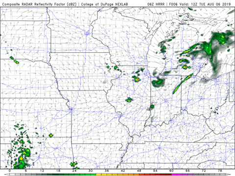
Today will feel pretty hot and muggy, so those late afternoon/early evening showers might feel great by the time they arrive. Scattered showers will transform into a more linear structure as we get later into the evening.
Possible Morning Showers Tomorrow
There is a slight chance that today’s showers may continue through the night and into tomorrow morning. However, things should clear up by lunchtime. The rest of the day looks free from rain and a few degrees cooler thanks to the passing of a weak cold front.
The cold front will leave behind high temperatures in the mid-80s. Dew points will remain high because of all the moisture in the air, but a slight break in temperature should feel great.
Rain Chances Again On Thursday
As of now, it looks like a large system approaching from the east will start to break down as it reaches Kentucky’s western border. However, that doesn’t mean that we are free from the possibility of showers. The best chance for rain will probably be in the late afternoon/early evening.
As for temperatures, we will get back up to the upper-80s with low-70s dew points. Overall, Thursday looks very hot and muggy with the possibility of relief later in the day.
End of the Week/Weekend Outlook
Friday will bring greater chances of showers and thunderstorms as the stationary boundary that has been parked near the Tennessee border transitions into a cold front and moves out of the area. These greater shower and thunderstorm chances will last the majority of the day but a strong wind shift to the north will bring our high temperatures down to the mid-80s. Saturday and Sunday look warm and dry.
That concludes today’s post! Have a great Tuesday and remember to follow @wxornotBG on Twitter for live updates on this week’s weather. See you next time!