
 @wxornotBG Facebook
 @wxornotBG Twitter
 @wxornotBG Instagram

Good morning, Kentucky! We’ve got more of the same forecast on the table: hot with scattered thunderstorms likely the rest of the week. The 4th is looking muggy but scattered storms should clear out in time for fireworks. I’ve got all the details below!

Stormy Afternoon Today
We’ll remain dry this morning as temperatures ramp up to the upper-80s and dew points reach the low-70s. As the afternoon rolls around, scattered thunderstorms will start popping up all over the map. This will be a very similar scenario to what we have been experiencing.
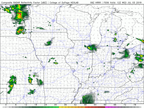
The heat index will be in the upper-90s again, so make sure to stay hydrated and wear sunscreen if you go outside.
Independence Day
Celebrating the freedom of our country calls for fireworks, red, white and blue and hot temperatures.

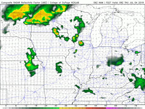
Tomorrow will be another repeat of the same forecast. Our morning will start of dry with the possibility of scattered thunderstorms near and after lunch time. Temperatures will reach the upper-80s and dew points will be back in the 70s once again.
Fireworks Forecast
Thunderstorms should clear out by the time it gets dark but a scattered shower can’t be ruled out. Temperatures will be in the low-80s but it will still be pretty muggy. Wind speeds will taper off to about 5 MPH or less.
More Of the Same On Friday
Rinse and repeat for the end of this week. Temperatures and dew points will feel like the rest of this week and the possibility for scattered afternoon thunderstorms is back once again.
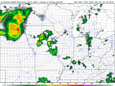
Thunderstorm chances will begin during the late morning and continue through the afternoon. The evening should clear up long enough to prepare for the returning storms on Saturday.
Weekend Outlook
The weekend is looking very similar to this week. Hot with thunderstorm chances in the afternoon on Saturday and Sunday.
That concludes this morning’s post! I hope everyone has fun and safe 4th of July celebrations while remembering to stay cool and hydrated. Have a great week!